Info
Center
Here you will find documents, reports and updated maps accounting for the culture and territories of these human groups, as well as the violation of rights, pressures and threats to which they are subjected.
Reports and
Publications


POLITICAL DECLARATION OF THE INDIGENOUS PEOPLES OF THE AMAZON BASIN AND ALL BIOMES OF BRAZIL FOR COP30
La declaración insta a los gobiernos amazónicos a actuar con seguridad jurídica para proteger a los PIACI, reconociendo legalmente a los pueblos en aislamiento y garantizando su territorio. Además, exige marcos legales que protejan los derechos territoriales, culturales y existenciales de los PIACI, con protocolos propios.

Indigenous Peoples in Isolation Infographics
In Latin America, there are 185 Indigenous Peoples in Isolation currently at RISK! These Peoples in a state of extreme vulnerability face eight main threats that are the result of an agro-extractive and export-oriented development model protected by the States at all costs: Setback of territorial rights, deforestation, mining, oil and gas extraction, hydroelectric dams, road and highway construction, hot spots, drug trafficking.

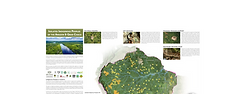
REGIONAL REPORT OF INDIGENOUS PEOPLES IN ISOLATION IN THE AMAZON AND GRAN CHACO: TERRITORIES AND DEVELOPMENT
This report has been an enormous collective effort to gather information in seven countries (Brazil, Colombia, Ecuador, Paraguay, Peru and Venezuela) and in different regions. The document brings together the valuable experience of many indigenous and civil society organizations working to protect other isolated indigenous groups. The report includes a country chapter as well as a regional analysis of the situation of IPACI. In addition to the local and regional analysis, the report presents concrete recommendations to states, multilateral agencies and the organized civil society from the perspective of strengthening the protection of IPACI.

REGIONAL METHODOLOGY REPORT: Principles and guidelines for the formulation of methodologies for the RECOGNITION OF THE EXISTENCE OF INDIGENOUS PEOPLES IN ISOLATION in South America in 2025
This document is a fundamental tool for strengthening the legal recognition of PIA in South America, providing principles and methodological guidelines to the States and organizations working for their protection and unifying technical and scientific criteria for the recognition of these peoples and their territories, positioning the situation of the PIA in key decision-making spaces. The report represents a milestone in the defense of PIA, the result of the commitment and collaboration of numerous indigenous and civil society organizations. This work continues to evolve and is key to further progress in the protection
of these peoples and their territories in the face of the growing threats they face.

IMPLEMENTATION OF FIRE POLICIES IN BRAZIL: AN ASSESSMENT OF FIRE DYNAMICS IN BRAZILIAN SAVANNA
In 2012, the Brazilian government implemented the Federal Brigades Program (FBP), a fire policy strategy to hire and train firefighters to combat wildfires. This study analyzed the impact of this program on fire behavior before (2008–2012) and after (2013–2017) its implementation in the Parque do Araguaia Indigenous Land, the largest indigenous territory with the highest occurrence of fires in the Brazilian tropical savanna. We analyzed the annual pattern of fire incidence in the dry season, the fire impact per vegetation type, the recurrence, and the relationship between fire and precipitation. The datasets were based on active fire products derived from the Moderate Resolution Imaging Spectroradiometer (MODIS), the Landsat and Resourcesat-based burned area products, and the records of the fire combat operations. Our results showed that FBP contributed to the reduction of the number of areas affected by fires and to the formation of a more heterogeneous environment composed of fire-resistant and fire-sensitive native vegetation fragments. On the other hand, after the implementation of the FBP, there was an increase in the recurrence of 3–4 years of fires. We concluded that the FBP is an important public policy capable of providing improvements in fire management activities.

TRINATIONAL REPORT SUMMARY: FIRES AND DEFORESTATION IN TERRITORIES WITH RECORDS OF INDIGENOUS PEOPLES IN ISOLATION: BOLIVIA - BRAZIL - PARAGUAY
This document is a summary of the Trinational Report: Fires and Deforestation in Territories with Records of Indigenous Peoples in Isolation: Bolivia - Brazil - Paraguay. The summary presents the main findings from each of the countries as well as a regional analysis.

Executive Summary: REGIONAL METHODOLOGY REPORT: Principles and guidelines for the formulation of methodologies for the RECOGNITION OF THE EXISTENCE OF INDIGENOUS PEOPLES IN ISOLATION in South America 2025
According to the International Working Group for the Protection of Indigenous Peoples in Isolation and Initial Contact (gti-piaci)1, in South America, there are 188 records of Indigenous Peoples in Isolation – pia (acronym in spanish). Of these, only 60 are officially “recognized registers”, leaving 128 registers that, for the States, do not exist. However, there are 31 records recognized by indigenous peoples and civil society organizations (ngos) that are not included in the official lists of the States.

TRI-NATIONAL REPORT: FIRES AND DEFORESTATION IN TERRITORIES WITH RECORDS OF INDIGENOUS PEOPLES IN ISOLATION: BOLIVIA - BRAZIL - PARAGUAY
This report presents the impacts of fires recorded during 2019 for Indigenous Peoples in Isolation and Initial Contact (PIACI) and their territories, based on a methodology that incorporates three local situation reports. In these reports, the voices of the peoples who share territory with the PIACIs play a central role. Through maps, geo-referenced information and direct testimonies, the report reconstructs the serious events that occurred during 2019 in vast regions of the Amazon and the Gran Chaco Americano.
Maps and Infographics